Home
Home

 Artists
 Search
 Recent
 Random
 Posts
Posts
 DMs
DMs
 Tags
Tags
 Random
 Importer
 Import
 FAQ
FAQ
 Account
 Register
 Favorites
 Login
Login

Ferret, Avian, Scud, and Mars Planetary Maps (Patreon)
Content
I've been scribbling a lot of planets lately, mostly because I'm currently working with Chirstopher Maida to make more detailed topographical versions of them. I was really really happy with the work he did for the centaur homeplanet so I'm just gonna keep commissioning him until he gets busy with something else or I run out of cash.
Some info on these planets!
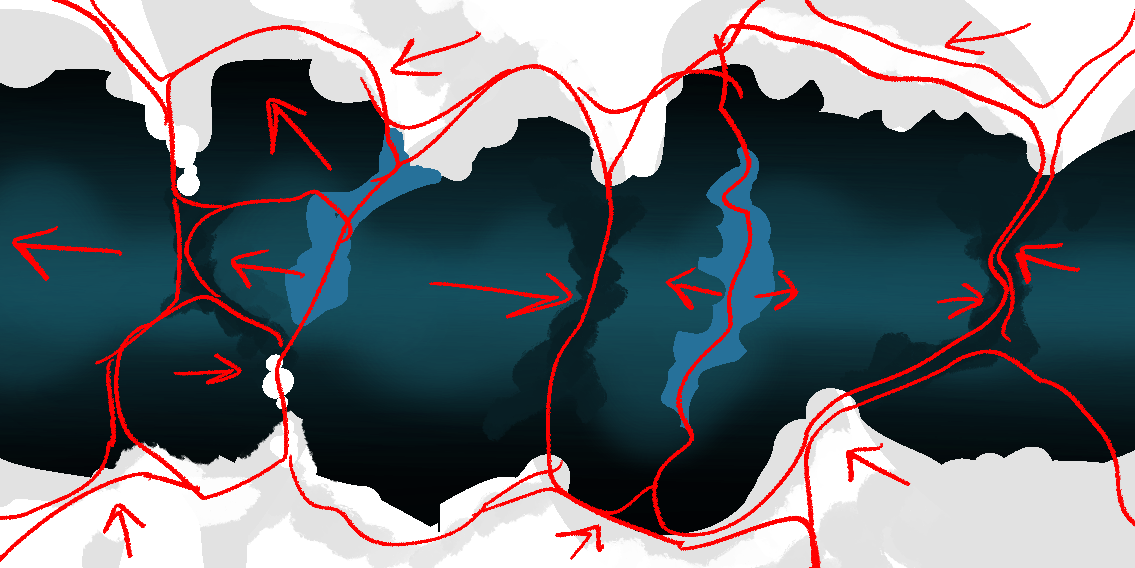
The bug ferret homeplanet is very cold with a negligible axial tilt, creating massive permanent ice fields at the poles that have locked up most of the planet's water. Two small, very salty and shallow oceans sit near the equator. Most of the exciting stuff is happening underground in the tropics, but I have to figure out how a flat map of that is going to even work. Plants get darker as you move towards the poles, because they're trying to absorb as much of the visual spectrum as possible. The star their planet orbits is lower intensity than ours.
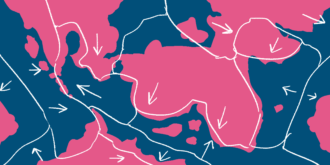
I've shown the avian homeplanet before, but yeah, I decided their ocean is red. There's a couple of factors at play here: first of all, it was driving me nuts that the flora on the land was blue and black when the color of ocean water is generally dark blue. It made designing attractive and legible maps very annoying. Second of all, the avian homeplanet has a preposterously high percentage of cobalt in its crust, over 5%, which is around as much iron as there is in Earth's crust. Cobalt is much more soluble in water than iron is, and the majority of cobalt salts are pretty distinctly pinkish red in color, certainly enough to color the saltwater on a planet like this. So a wine-dark sea it is. If I ever get around to coloring Airsled, this will certainly make things more interesting. The second two avian maps are Christ Maida's work with some ocean overpaintings by me.
The scud homeplanet is almost 50% land, because I thought the irony was funny. Lots of nice coastline for settlement, though, a favored scud habitat. I also recently decided the terrestrial flora is red-to-pink, because having both the bug ferret planet and them with cyan flora was boring. Some equatorial scud plants even appear white, because they have a higher intensity star than us.
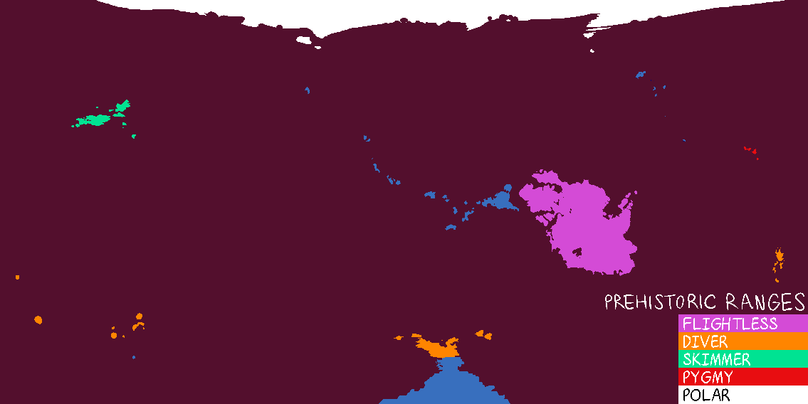
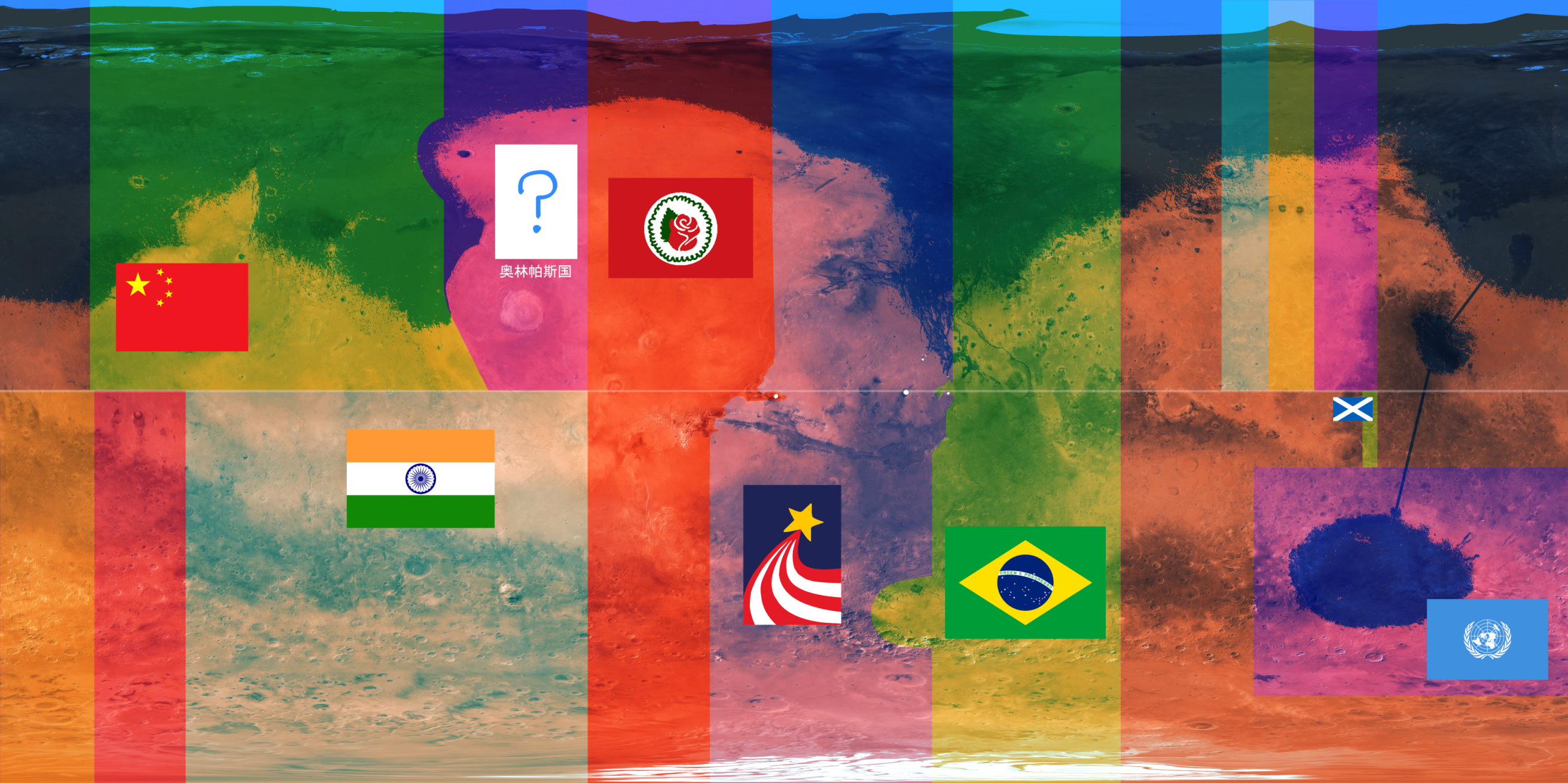
Mars as been a real headache to figure out. It's currently pretty early into both permanent colonization and terraforming, so the northern polar ocean is pretty small, most of the land is still dry dead desert, and the countries are all pie slices, similar to territories in Antarctica. The USA was the fastest to make it to Mars and claim a big chunk of land, but since the country was shattered after WW3 its remains on Mars are the Socialist Republic of Mars (rose flag) and the United Valley States (rising star flag). They hate each other. China survived WW3 with most of its Earth-based empire intact, but internal ideological conflict bled over the comparatively harder to jurisdict Mars, and a libertarian communist state broke off their Martian territory. Still debating what to name them, but their territory includes Olympus Mons and honestly "Olympus" is a pretty baller country name. China is not a fan of their existence. The right part of the map there is a work in progress, but it's going to turn into a United Nations jurisdiction blob of microterritories, all staked by Earth countries who came late to the Martian land grab craze.
Files