Home
Home

 Artists
 Search
 Recent
 Random
 Posts
Posts
 DMs
DMs
 Tags
Tags
 Random
 Importer
 Import
 FAQ
FAQ
 Account
 Register
 Favorites
 Login
Login

Karaczun’s Hollows (Patreon)
Content
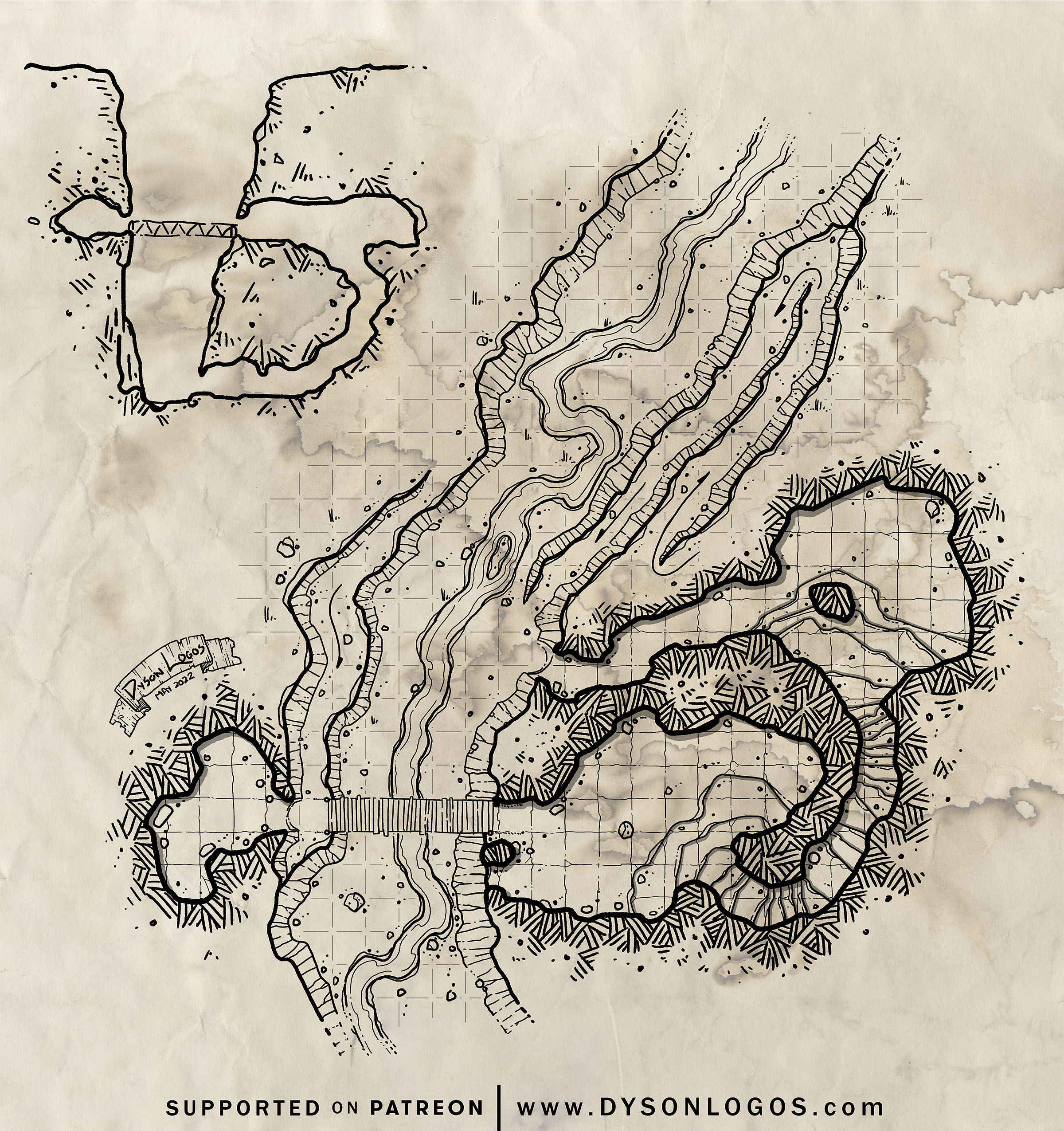
A day’s walk south of GravelThorpe is a gully cut into the soil by the Karaczun – a stream of runoff from the melting glacier that once covered the ruins of the dwarven citadel of Urul-Dar. The gully here is home to a small set of caves and some enterprising halflings from the town had used the location as a base of operations to pan for artifacts in the stream.
They would find the occasional interesting bit of dwarven stonework as well as a pair of cut and polished rubies, and eventually built a bridge across to the second cave, linking the two sides of the gully. This smaller cave they used to store their finds while they would camp in the larger upper cave across the gully. At least, until they were chased out of the caves by a small group of halfling-eating humanoids of some kind.
But with the uncovering of Urul-Dar, there are many adventurers in town… and the halflings who used to pan from Karaczun’s Hollows have a plan to get their place back. They will offer adventurers directions to where they used to pan for dwarven treasure (and show off one of the two rubies as proof of the great treasures to be found while lamenting that they left most of the goods they acquired back in the caves – which is true, but those goods are all stonework and bits of pottery) for a small sum, allowing the adventurers to clear the caves for essentially no reward…
This map is dedicated to the memory of Alex Karaczun, who we lost suddenly and far too soon last night.
The 1200 dpi versions of the map were drawn at a scale of 300 pixels per square and are 9,600 pixels (32 squares) wide. To use this with a VTT you would need to resize the squares to either 70 pixels (for 5′ squares) or 140 pixels (for 10′ squares) – so resizing it to either 2,240 pixels wide or 4,480 pixels wide, respectively.
Files