Home
Home

 Artists
 Search
 Recent
 Random
 Posts
Posts
 DMs
DMs
 Tags
Tags
 Random
 Importer
 Import
 FAQ
FAQ
 Account
 Register
 Favorites
 Login
Login

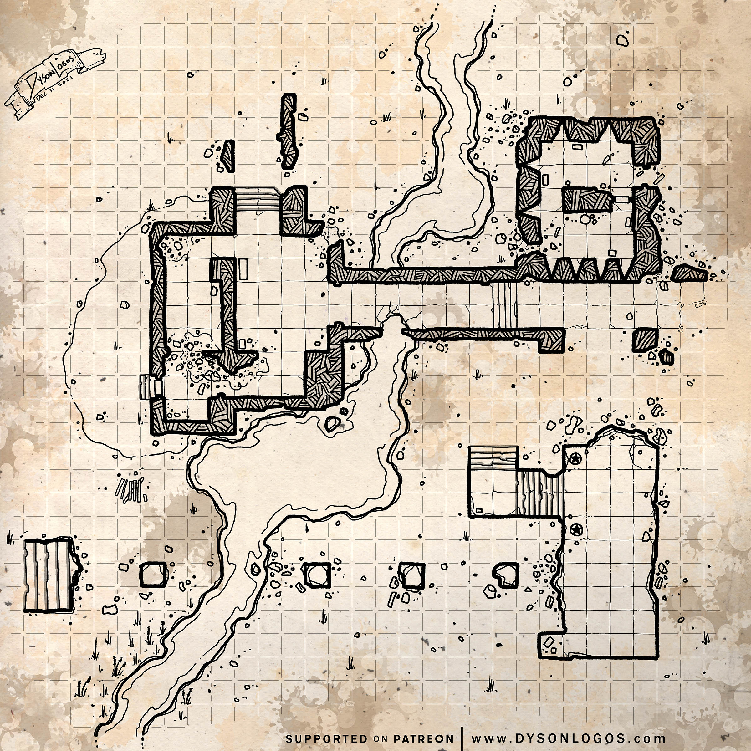
Fortified Bridge Ruins (Patreon)
Content
The stream running under these ruins was once much more formidable – blocking easy traffic for miles up and downriver. And thus these bridges were built and now abandoned. The all-stone construction of the northern bridge has fared much better than the southern span which was made of wood laid across a series of stone supports. The southern bridge was for general traffic and had wooden ramps leading up to it (over the stairs on the left side of the span and extending off to the right of the right side of the span).
The fortifications are still standing along the northern span – although the wooden roofing has long decayed or been burned off by careless visitors. The ruins are still used by travellers on foot or horseback but are quite difficult for carts and impassable to wider wagons. Some evenings you will find other travellers setting up camp in the ruins as they provide a modicum of protection against the elements and wild animals.
If you are particularly unlucky you will instead run into bandits, ne’er-do-wells, or those who would rather not have their movements spotted or reported upon…
The 1200 dpi versions of the map were drawn at a scale of 300 pixels per square and are 9,600 pixels (32 squares) wide. To use this with a VTT you would need to resize the squares to either 70 pixels (for 5′ squares) or 140 pixels (for 10′ squares) – so resizing it to either 2,240 pixels wide or 4,480 pixels wide, respectively.
Files