Home
Home

 Artists
 Search
 Recent
 Random
 Posts
Posts
 DMs
DMs
 Tags
Tags
 Random
 Importer
 Import
 FAQ
FAQ
 Account
 Register
 Favorites
 Login
Login

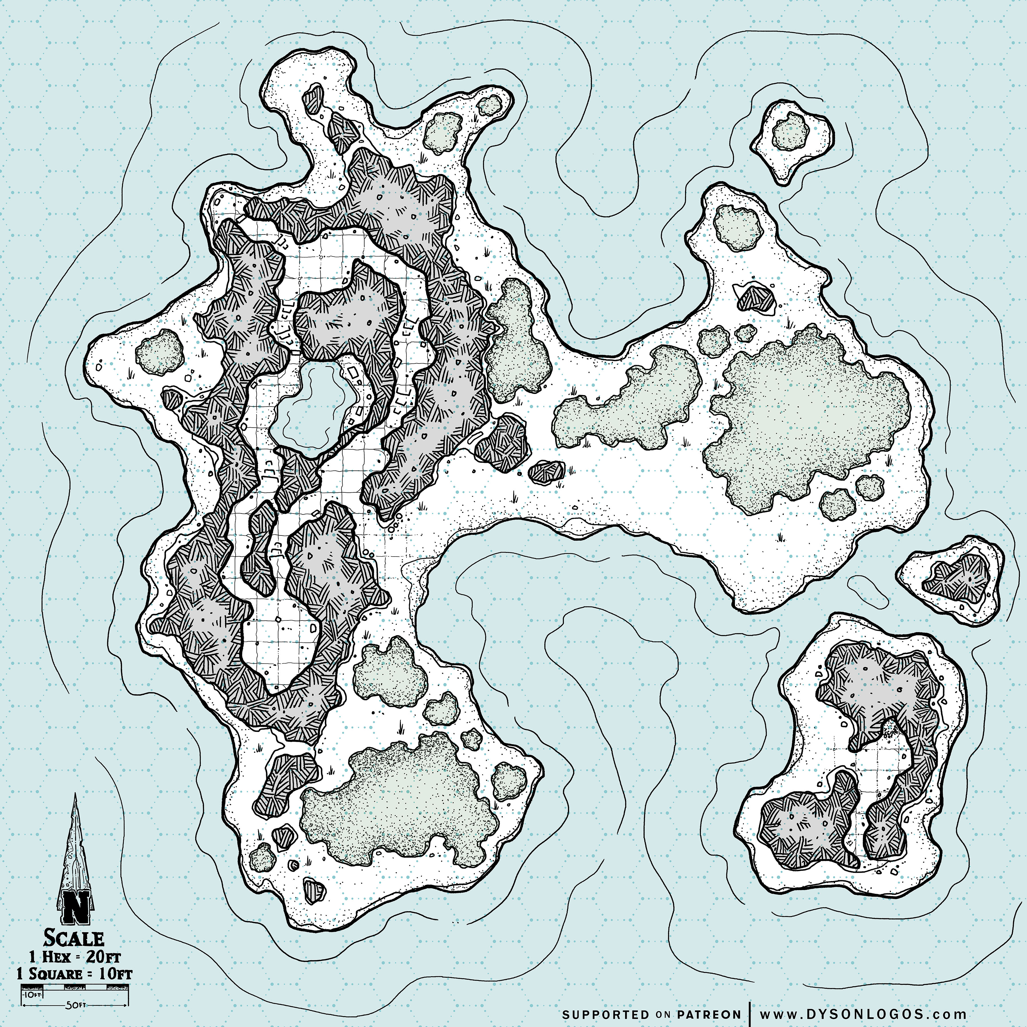
Pirate Booty Island (Patreon)
Content
I’m sure this island has a better name, a local name, something the nearby natives call it… but on the map, it is marked as Pirate Booty Island, and thus that is what we call it.
Actually a collection of four small rocky islands in the shallows, the main point of interest is the rocky peak on the main island. Rough caves pierce these rough stones. At the heart of these caves is a sunken chamber with a pool of brackish seawater and, of course, a significant collection of pirate treasure left here as an emergency cache by Washburn ‘Silver Teeth’ Smyth. At one point the islands and small bay were used as a pirate outpost, with small bases in the caves of the main island and the second largest. Of these outposts, all that remains today is blackened sand where fires were once tended in the smaller island’s cave, and a rotten wooden door on the northwest point of the main island that leads up to a raised “lookout”.
The sands of the island are home to a small number of venomous snakes and the stones to harmless small lizards. Aside from that, the main risk while hunting for Silver Teeth’s treasure will be other pirates and treasure hunters seeking to find (or protect) the same cache.
Unlike most of my maps, I have included a scale on this one, but it can be easily changed. The hexes (placed using the HexPaperPro font) are 20 feet from flat to flat, and the squares used in the caves are half that.
The 1200 dpi versions of the map were drawn at a scale of 300 pixels per square and are 14,400 pixels (48 squares) wide. To use this with a VTT you would need to resize the squares to either 70 pixels (for 5′ squares) or 140 pixels (for 10′ squares) – so resizing it to either 3,360 pixels wide or 6,720 pixels wide, respectively.
Files