Home
Home

 Artists
 Search
 Recent
 Random
 Posts
Posts
 DMs
DMs
 Tags
Tags
 Random
 Importer
 Import
 FAQ
FAQ
 Account
 Register
 Favorites
 Login
Login

The Y'ruvex Swamps (Patreon)
Content
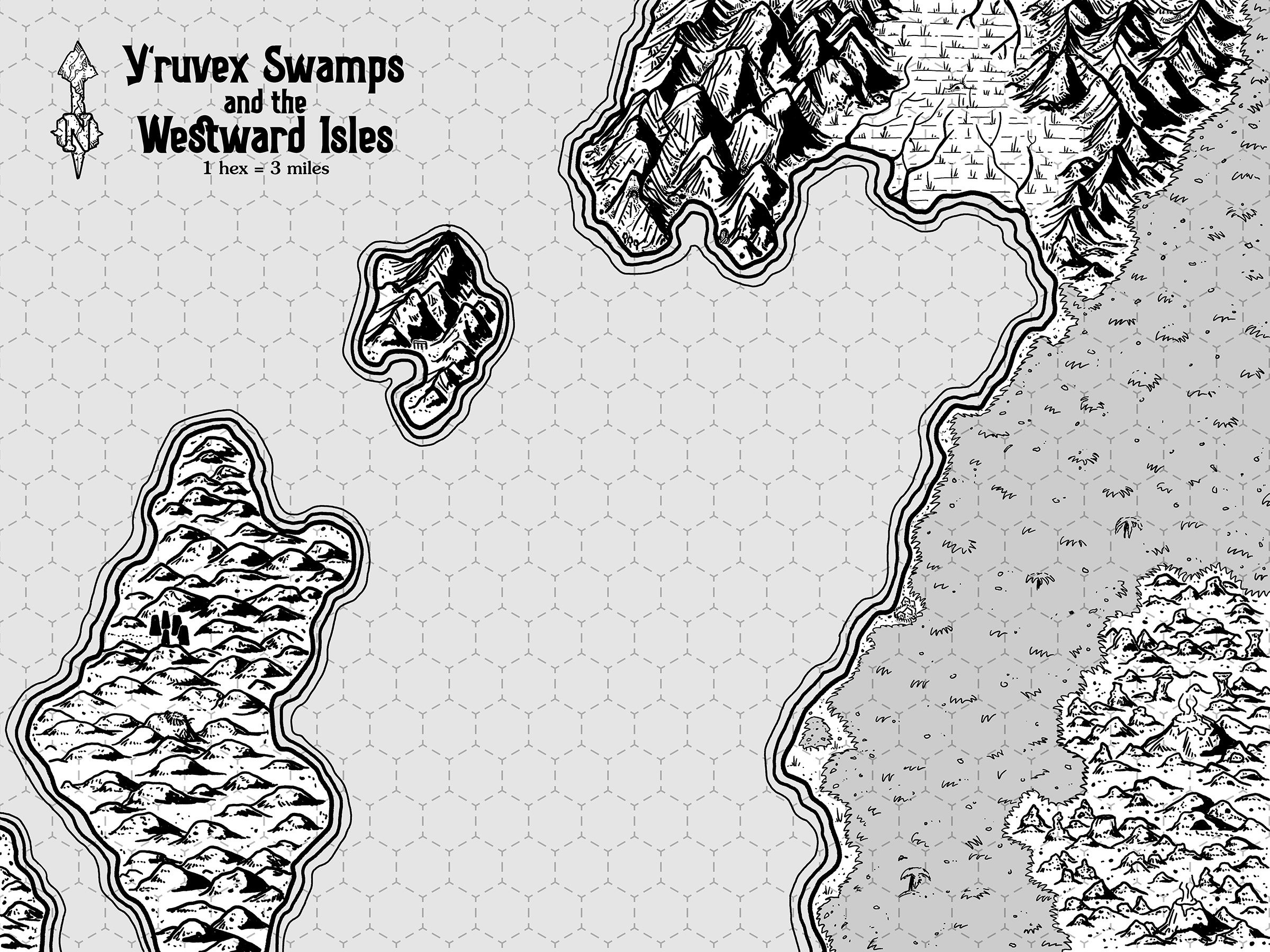
The only major river inlet on the whole of the island is the Y’ruvex Swamps, a marshy lowland pincered between mountain ranges. We believed that if we could get past the swamps themselves and to the open rivers beyond, they would likely lead us to the heart of this island and the rumoured central plateau.
But nothing healthy grows in those swamps and the mountains around them show the spoor of the mightiest of territorial predators – dragons. The Jale folk call the river valley “the Central River” in their strange tongue and the the swamp name probably translates to something like “place where the people drown and die” – a proper translation wasn’t forthcoming as our Jale guide was killed when the hippogriffs attacked us on the larger of the hilly islands. We had pulled ashore to examine the massive standing stones just visible from the shore only to discover that the tallest hill on the island is home to a large nest of the beasts.
This map is actually a stylized closeup (at roughly 3 miles per hex) of one section of the classic Isle of Dread adventure from my campaign where I mash it up with elements of the Carcosa setting. Of the classic Isle of Dread map, this shows encounter location 8 (the Hippogriff nest on the island), location 5 (the caves of the rock baboons on the lower right of the map between the volcanoes) and it doesn’t quite extend north enough for the Roc nest at 16. It also includes a lot of smaller details that were added as I imported Carcosan weirdness – megalithic standing stones on the island, a few mountain caves and shore details to attract explorers’ attention, and such.
Files