Home
Home

 Artists
 Search
 Recent
 Random
 Posts
Posts
 DMs
DMs
 Tags
Tags
 Random
 Importer
 Import
 FAQ
FAQ
 Account
 Register
 Favorites
 Login
Login

Updates for July 2022 (Part 2) (Patreon)
Content

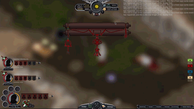
We're working a little bit ahead on a future feature that hasn't broken ground yet beyond initial concepts and art assets: the World Map & Travel system.
Normally the game is played on the Local Map, which is the isometric world on individual buildings and characters walking around, chopping trees and mining out resources. But as you head off the edges of the local map, your caravans enter this other dimension "above" that gameplay layer.
This World Map contains a lot of information that impacts your play.
There are weather regions, biomes, and the dynamic borders of the various factions & empires you share Morgana Fragment with.
You'll need to travel to visit other towns for resources that simply don't exist on your home's local map. There you can invade, trade, and explore for the things you need before heading back to your home base to drop things off and continue your exploration-trade-build-war loops.

We're spending the rest of July and August experimenting with art styles before Curtis wraps up his work on our Local Map procedural generation, which will feed this system a little bit as well.


We've been through a few concept art passes already, but we're beginning to zone in on the common elements that will allow our procedural generation to produce complex and interesting land forms to spend time looking at as you explore.
If you're familiar with Star Sector, this is the equivalent of Hyperspace, with the hyperspace clouds being our mountains and rivers, complete with thunderstorms and bad guys / good guys zooming around to interact with, and planets being cities.
We know we want it to look like pen & paper, but still retain a lot of color and details. There's a lot of information to convey too. What tiles are in what biome? What faction territory owns this area? Can I settle here? Is the copper I need on this tile?
It's a lot to convey. So we're starting an early dive into fleshing that out as the Local Maps get their priority attention.

Curtis has continued the work we talked about in May-June on the procedural generation for our local maps.
In this example above, the tiles in white are terrain, and the black is hydrology, like the water maps.
The land expands organically from layers and layers of information, placing cliffs, grass, rocks, trees, all the details you may ever want to see. Most importantly, the variations in terrain and the data layers that come with destructible terrain.
It's a super complex problem, and Curtis has worked hard turning it from the theory to the practice. There has been lot of optimization on how to store so much data in an efficient manner that really dives deep into the theoretical aspects of computer science. The large volume of data is crippling to computers, so abstracting that with a lot of filters and nodes and layers has been vita to compress that data into something manageable, while still allowing individual tiles to be changes in realtime during mining, wildfires, etc.
This image above, every pixel represents a single tile.
It's hard to grasp just how huge that is.


The individual tiles these characters are standing on is already 1024x512. It takes Tens of thousands of tiles to make a whole map!
Obviously we can never bake any of that to a static image, so that means rendering every tile in realtime as a discrete sprite.
But first, you have to generate the data for what edges to place next to which solids, and how they all fit together without overlapping. That's where this GPU powered procedural generation comes in, on a far smaller image, where individual pixels represent the big tile sprites.
We can save those tiny images to the hard drive when we save maps to hard drive or edit them in memory, and it takes hardly any time or space at all. As players modify layers of that data, we just update the saved information on that image with a GPU process, which is very fast.
That's vital when we leave a local map and come back later.
Data like the exact position of each grass tile may change, but it saves the big picture changes, like where buildings are and cliffs, and the terrain remains the same.
This will allow our game to feel very lived in, the terrain to feel like real nature, and we can save & load maps to create what feels like gigantic planet-sized Fragment, without killing your PC. Even older hardware should scale down to smaller map sizes and lower detail, and still run it, without choking to death on all this data if we'd just rendered every tile the old fashioned way.
We hope this July will be the last month we spend in the dark, waiting for our procedural generation to move from these abstract images into concrete playable spaces that generate realistic looking terrain. It's been quite a journey and required a ton of wizardry, but the final product should be impressive, both visually and in gameplay.
We'll spend August refining the local map visually, insuring all the cliffs and after tiles are looking the best they can and the rules are tweaked, and establishing the system we use for saving and loading individual maps. The rest of September into October will be all about getting resources to spawn on the map, and have them be minable and reachable by characters. Early balance on that just for the sake of understanding where that comes in later as a gameplay strategy. Just enough to form a picture so we can establish more tools to balance gameplay.
Then we can hand that to Kent and his work on our JobDriver and we start work on this Overworld map system.
Files